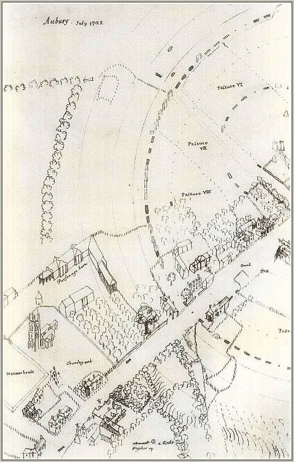
| This is a drawing that William Stukeley made of the village and henge in 1723. It contains much fascinating detail of stones that were present at that time. Of note are the stones that are adjacent to the Swindon Stone whose partner on the other side of the road reportedly fell in 1722....the year before this drawing was made. Two stones of the Beckhampton Avenue are shown lying in the High Street and three recumbent stones of the northern inner circle that are in the north-west quadrant of the outer circle are also apparent. Several of the village buildings visible today are recognizable including the dove-cote which is behind the Church. |
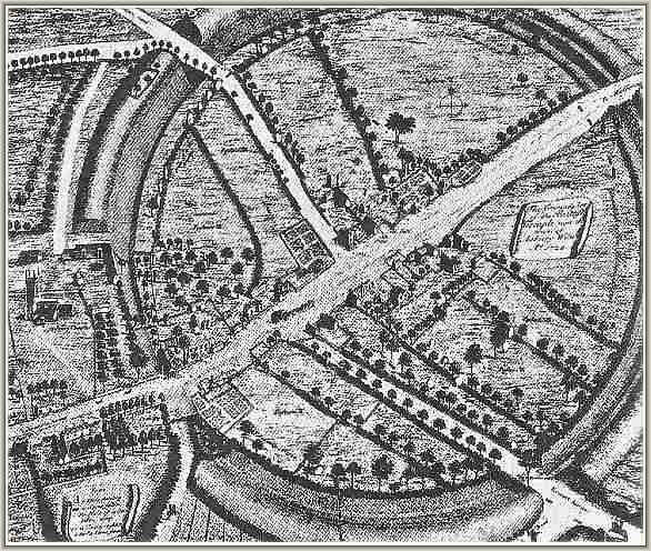
| Stukeley produced a more refined drawing in 1724. Unfortunately this reproduction of it lacks sufficient clarity to make out some details with certainty. However two stones laying in the road at the eastern entrance are obvious as are two stones of the West Kennet avenue which also appear to lie in the road. NOTE: A large scale copy of this plan can now be accessed from "The Shame" page. |
| |