
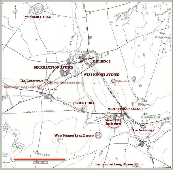
Although the map only highlights the well-known features of Avebury the whole area contains an abundance of lesser sites relating to the Neolithic and Bronze-Age periods. The Ridgeway which skirts the side of the Sanctuary was one of the main trade routes in the British Isles at that time. Without visiting the area it is difficult to fully appreciate the awesome scale of the monuments as they relate to the surrounding landscape.
A number of springs exist in the area of Avebury which must have had great significance to the builders of the monuments. Midway between Silbury Hill and the West Kennet Long Barrow Swallowhead Spring is marked prominently on the older maps shown below. Many visitors to the area still make a pilgrimage to this revered place on the stream that feeds the River Kennet. In recent years it has become a repository for a variety of "offerings". Unfortunately some of the less bio-degradable can give this picturesque spot the appearance of a rubbish tip on occasions.
CLICK HERE FOR A PANORAMIC
IMAGE OF THE AVEBURY LANDSCAPE
SHOWING THE LOCATIONS OF THE MAJOR COMPONENTS
image size 300K
image size 100K
NOTE: The 300K versions are most suitable for broadband users as
download time with a 56K modem
is usually 1-2 minutes.
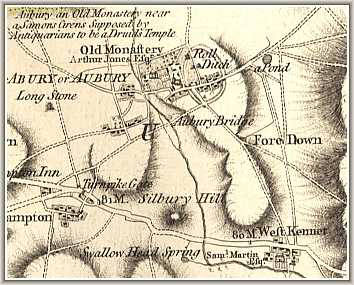
Map of Avebury area circa.1773
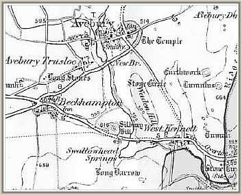
Map of Avebury area circa.1896
This shows the locations of the
neolithic components on a large
scale view of the area.
WARNING: for dial-up users.
This is a 500k download

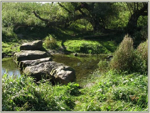
Swallowhead Spring lies on a secluded corner of the youthful River Kennet.